Mount Kalaga National Park · screenshot 4
A red-clay canyon
Official GTA 6 screenshot, explained
GTA 6 screenshots explained › Mount Kalaga National Park › Mount Kalaga National Park 4

What it shows
A river canyon of red clay and pines, with a road bridge in the distance.
A canyon trail in Mount Kalaga National Park.
A trail in Mount Kalaga National Park.
| Set | Mount Kalaga National Park |
| Screenshot | Mount Kalaga National Park 4 |
| Source | Rockstar Games Confirmed |
What we spotted in it
1 item from our Oracle, the catalogue of everything seen in the official screenshots. “Our guess” means Rockstar has not said what the item does.
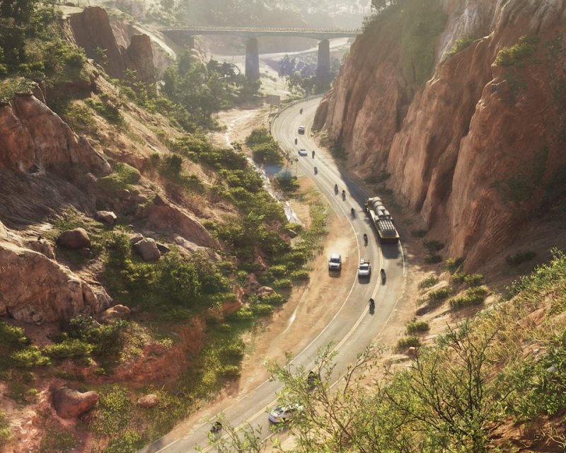 Canyon highway and rail bridgePlaces · Reported
A two-lane road winding through red rock cuttings in the hills, traffic in both directions and a bridge ahead.
Confirmed: the road north into Mount Kalaga. Edge reports the map opens early, so this drive is available before the story takes you there.
On the map
This screenshot is pinned on our interactive map as “A red-clay canyon”. Rockstar does not publish locations for its screenshots, so the placement is our estimate.
Where we have written about it
← Mount Kalaga National Park 3All screenshots explained · The galleryMount Kalaga National Park 5 →
Screenshot © Rockstar Games / Take-Two Interactive. SixStarsWanted is an unofficial fan site. The descriptions and guesses are ours.